Hand outs and Visual Aids

Handout Time!

Here it is, one rough map of the immediate area...

There is no particular scale, though I am going with 1" = 1/4 Mile (or 400 M). Contour lines are +/- 25ft above water, +/- 10ft below water.

Basically, the distance from the covenant to the in should be 1 1/4 miles.

I apologize for the rough look, I didn't have time to make it look nice...

Steve

Um, since different monitor sizes produce different maps, that is not as useful as it might be. :wink:

Sounds good, don't worry about detail, that only invites confusion.

I'll Start a handouts thread for maps, and such...

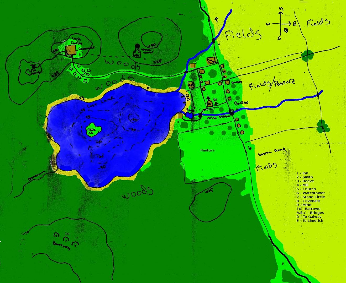
For everyone's reference, the image is roughly 8 x 10 (203mm x 254mm). So, 1/4 mile (or 400m) should be roughly 180 pixels.

And it wasn't exactly detail I was looking for, but a fair amount of polish. Instead of blobs of color, I was looking for something a bit nicer; you could tell that the fields were fields, the grass was grass, that those are buildings of different shapes and sizes, etc.

I have the tools to do professional looking maps, and prefer them for clarity's sake, not detail.

Steve

And... 1 rough layout of the covenant. Building Footprints are shown, with a scale, in Feet.

KEY
1 Gatehouse
2 Grog Barracks
3 Guest Cottages
4 Eastern Labs
4a Sylphie's (Unoccupied)
4b Torsten's (Unoccupied)
4c Glendower's (Unoccupied, Sealed)
5 Angus O'Connor's residence
6 Feasthall (Council chamber on the west side)
7 Library and Scriptorium
7a Library & Sciptorium
7b Vellum Maker
8 Western Labs
8a Diedre's Lab (Occupied)
8b Kallias' Lab (Unoccupied)
8c Mab's Lab (Occupied)
9 Tin Bunker
10 Stables and Sundry
10a Tanner
10b Smithy
10c Barn
10d Stables & Paddock

Not shown are the paths and road, and any vegetation within the circle.

Steve