[i](Inspired by a recent thread, Ithought I'd post this here as a separate topic rather than completely derail the other.
And I'm sure there are other threads on this subject - if anyone has a link, feel free to post, thx!)[/i]
In a word, my opinion is "No, not (very) reliable for navigating while flying". For walking/sailing, sure, but not flying.
The problem is that maps of this era all took the approach of a Subway/Tube Map (http://en.wikipedia.org/wiki/Tube_map) - which shows the best way to get from A to B, and from B to C, and from C to A, but doesn't represent any actual spatial relationship between those 3 points. Which makes sense - no one cared about actual relative positions re the compass - just how to walk/sail there. If the map did that, it was reliable and therefore "accurate".
So, a map of the coast of England could be drawn in one long straight line, or as a perfect circle, or a series of S-shapes (to save space!) - the distances between ports and any significant headlands/landmarks was all that mattered. Accurate.
Here's a top-quality map of the whole world, perfect for flying long distances. Of course, it's ca. 1321, and so far more advance and detailed than maps of our era... (north is "left")

Pietro Vesconte, 1321
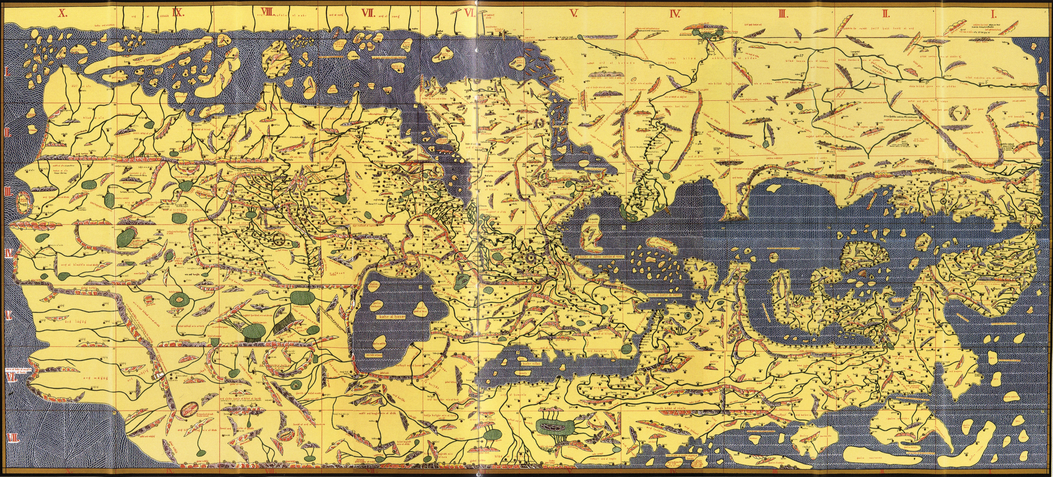
Here's a map that shows how to get to anywhere in the Islamic world, ca.1154. And because it's Islamic, it is so much, MUCH better and more advanced than equivalent European maps of the era. I'm sure you'll recognize the Med' in the right half of the map... (North is "down"!) The "east" coast of Africa is seen across the top-left of the map (for convenience rather than any "accurate relationship"). (EDIT: fixed, thanks to Tugdual!)

al-Idrisi, ca 1154
(Here's a detailed view of same, too big to post here.)
http://upload.wikimedia.org/wikipedia/commons/d/d3/TabulaRogeriana.jpg
Her's a wonderful map of Great Britain. Of course, this also is a very bad example, because it is so much more accurate and detailed than AM era maps would be, being ca 1360.
(Edit: map link gone: see en.wikipedia.org/wiki/Gough_Map )
Gough Map of Great Britain, ca 1360
Ah! Here we go! This world map is much closer to what we're dealing with, but still shows clear signs of how much cartography advanced in the 60 years since 1220. (It even shows the location of Noah's Ark - talk about convenience!) I'll let you orient yourself. (Hint - North is east on this one too... I'm pretty sure...)

Hereford Mappa Mundi, Hereford Cathedral, ca 1280
(If this is worth a closer look: http://en.wikipedia.org/wiki/Hereford_Mappa_Mundi )
(Edit - replaced some broken links)